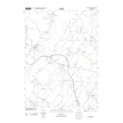
2013 Map of Wurtsboro
USGS Topo · Published 2013About this map
Wurtsboro and the surrounding valley corridor appear here in 2013, defined by the persistent flow of the Basher Kill and Shawangunk Kill. The landscape is a mix of small settlements and aviation hubs, featuring both the Wurtsboro-Sullivan County Airport and the Sha-Wan-Ga Valley Airport. The mapping reveals a transition from the elevated terrain of Roosa Gap and Wurtsboro Hills down to the established hamlets of Bloomingburg, Circleville, and Summitville. Genealogists and local historians can locate several burial grounds, including the Stanton Memorial Cem and Sylvan Cem, while the southern reaches show the rural character of Maple Glen and New Vernon. Distinctive landmarks such as the Fair Oaks Drive-In and American Legion Camp highlight the area's role in local recreation and community gathering during the early 21st century.
Find a feature on this map
192 named features on this map. Tap any name to fly to it.
Don’t see what you’re looking for? This feature index may not catch every label — zoom into the map to look around manually.
Map Details
Editions of this 2013 Wurtsboro Map
This is the sole edition of this map. No revisions or reprints were ever made.
Other maps of this area

1904 · Ellenville
USGS Topo · 1:62,500

1906 · Ellenville
USGS Topo · 1:62,500

1906 · Port Jervis
USGS Topo · 1:62,500

1906 · Goshen
USGS Topo · 1:62,500

1908 · Goshen
USGS Topo · 1:62,500

1908 · Port Jervis
USGS Topo · 1:62,500

1909 · Monticello
USGS Topo · 1:62,500

1911 · Monticello
USGS Topo · 1:62,500

1938 · Goshen
USGS Topo · 1:62,500

1942 · Goshen
USGS Topo · 1:24,000