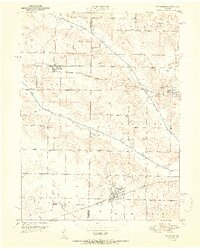
1951 Map of Wyaconda
USGS Topo · Published 1951About this map
Wyaconda serves as a primary hub in this corner of Northeast Missouri, where the Atchison Topeka and Santa Fe railroad cuts across the southern portion of the landscape. To the north, the Chicago Burlington and Quincy tracks link the smaller settlements of Granger and Luray. The geography is defined by the winding paths of the South Wyaconda River and the Old North Wyaconda River Channel, reflecting a terrain shaped by riparian shifts and drainage.
Find a feature on this map
29 named features on this map. Tap any name to fly to it.
Don’t see what you’re looking for? This feature index may not catch every label — zoom into the map to look around manually.
Map Details
Editions of this 1951 Wyaconda Map
2 editions found
Other maps of this area

1903 · Kahoka
USGS Topo · 1:125,000

1903 · Edina
USGS Topo · 1:125,000

1950 · Neeper
USGS Topo · 1:24,000

1950 · Medill
USGS Topo · 1:24,000

1950 · Colony
USGS Topo · 1:24,000

1951 · Colony
USGS Topo · 1:24,000

1951 · Neeper
USGS Topo · 1:24,000

1951 · Medill
USGS Topo · 1:24,000

1951 · Wyaconda
USGS Topo · 1:24,000

1954 · Centerville
USGS Topo · 1:250,000