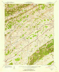
1938 Map of Wyndale
USGS Topo · Published 1957About this map
Walker Mountain and the parallel ridges of Rich Valley and Preston Valley define the Southwest Virginia landscape in this late 1930s survey. The Norfolk and Western Railway and the Lee Highway serve as the primary east-west arteries, cutting through the heart of the terrain and linking settlements like Wyndale and Greendale. This map reveals a high density of rural institutions, including dozens of country churches and schools that anchored these valley communities before the consolidation of the mid-20th century.
Find a feature on this map
52 named features on this map. Tap any name to fly to it.
Don’t see what you’re looking for? This feature index may not catch every label — zoom into the map to look around manually.
Map Details
Editions of this 1938 Wyndale Map
3 editions found
Other maps of this area

1891 · Abingdon
USGS Topo · 1:125,000

1894 · Abingdon
USGS Topo · 1:125,000

1897 · Bristol
USGS Topo · 1:125,000

1902 · Bristol
USGS Topo · 1:125,000

1909 · Abingdon
USGS Topo · 1:96,000

1911 · Abingdon
USGS Topo · 1:125,000

1918 · Carterton
USGS Topo · 1:62,500

1934 · Wallace
USGS Topo · 1:24,000

1934 · Holston Valley
USGS Topo · 1:24,000

1934 · Brumley
USGS Topo · 1:24,000