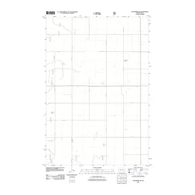
2011 Map of Wyndmere NW
USGS Topo · Published 2011About this map
Nordmanna Cemetery and Freeman Cemetery provide significant points of reference in this landscape of Richland County, North Dakota. The area is defined by a strict section-line grid of rural roads, including County Rd 23 and County Rd 8, which facilitate the agricultural rhythm of the plains. Small, scattered seasonal wetlands and depressions are visible across the prairie, indicating the natural hydrology that persists despite the organized land survey. The presence of these two cemeteries suggests a history of local community settlements and family legacies that have centered around these intersections for generations. This map reflects the steady, enduring character of Garborg Township, where the infrastructure of local routes like 155th Ave SE and 65th St SE connects isolated homesteads and maintains the connectivity of the rural heartland.
Find a feature on this map
14 named features on this map. Tap any name to fly to it.
Don’t see what you’re looking for? This feature index may not catch every label — zoom into the map to look around manually.
Map Details
Editions of this 2011 Wyndmere NW Map
This is the sole edition of this map. No revisions or reprints were ever made.
Other maps of this area

1895 · Casselton
USGS Topo · 1:125,000

1897 · Casselton
USGS Topo · 1:125,000

1907 · Wyndmere
USGS Topo · 1:125,000

1953 · Fargo
USGS Topo · 1:250,000

1956 · Fargo
USGS Topo · 1:250,000

1959 · Wyndmere NE
USGS Topo · 1:24,000

1960 · Wyndmere
USGS Topo · 1:24,000

1960 · Power
USGS Topo · 1:24,000

1960 · Barrie
USGS Topo · 1:24,000

1960 · Wyndmere NW
USGS Topo · 1:24,000