
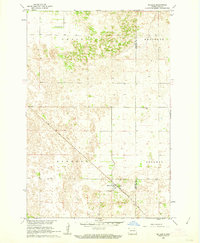
1960 Map of Wyndmere
USGS Topo · Published 1961About this map
The village of Wyndmere serves as the focal point of this 1960 topographic survey, situated at the crossing of two major rail lines: the Northern Pacific and the Minneapolis St Paul and Sault Ste Marie. This intersection defines the local geography, anchoring a landscape characterized by agricultural townships like Freeman, Garborg, and Homestead. The map documents a prairie environment punctuated by numerous depressions and several instances of a Flowing Well, vital for water access in the Red River Valley region.
Find a feature on this map
16 named features on this map. Tap any name to fly to it.
Don’t see what you’re looking for? This feature index may not catch every label — zoom into the map to look around manually.
Map Details
Editions of this 1960 Wyndmere Map
This is the sole edition of this map. No revisions or reprints were ever made.
Other maps of this area

1907 · Wyndmere
USGS Topo · 1:125,000

1953 · Fargo
USGS Topo · 1:250,000

1956 · Fargo
USGS Topo · 1:250,000

1958 · Hamlin
USGS Topo · 1:24,000

1959 · Wyndmere NE
USGS Topo · 1:24,000

1960 · Wyndmere NW
USGS Topo · 1:24,000

1960 · Wyndmere SE
USGS Topo · 1:24,000

1960 · De Lamere
USGS Topo · 1:24,000
1961 · McLeod
USGS Topo · 1:24,000

1964 · Kreiser Lake
USGS Topo · 1:24,000