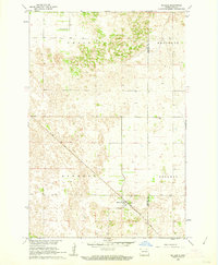
1961 Map of McLeod
USGS Topo · Published 1964About this map
The small settlement of McLeod serves as the primary focal point of this 1960s landscape, situated along the diagonal path of the Soo Line railroad. This survey was conducted as part of a Department of the Interior program for the development of the Missouri River Basin, capturing the rural character of the region across the Ransom and Richland County line. The terrain is divided into distinct administrative townships including Owego, Sheyenne, Sandown, and Freeman, reflecting the systematic grid-based land organization of eastern North Dakota. Genealogists may find particular value in the location of the Free Lutheran Cem in the northwestern corner, providing a clear coordinate for family research in this sparsely settled agricultural area.
Find a feature on this map
8 named features on this map. Tap any name to fly to it.
Don’t see what you’re looking for? This feature index may not catch every label — zoom into the map to look around manually.
Map Details
Editions of this 1961 McLeod Map
This is the sole edition of this map. No revisions or reprints were ever made.
Other maps of this area

1895 · Casselton
USGS Topo · 1:125,000

1897 · Casselton
USGS Topo · 1:125,000

1907 · Wyndmere
USGS Topo · 1:125,000

1953 · Fargo
USGS Topo · 1:250,000

1956 · Fargo
USGS Topo · 1:250,000

1960 · Wyndmere
USGS Topo · 1:24,000

1960 · Power
USGS Topo · 1:24,000

1960 · Wyndmere NW
USGS Topo · 1:24,000

1960 · Coburn
USGS Topo · 1:24,000

1960 · De Lamere
USGS Topo · 1:24,000