
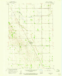
1959 Map of Wyndmere NE
USGS Topo · Published 1960About this map
The prairie landscape of Richland County is defined here by the township grid systems of Viking, Garborg, Nansen, and Colfax. This late 1950s survey documents a rural agricultural environment where community life centered on localized institutions like School No 1 and School No 3. Cultural landmarks include the Viking Ch and Gol Aal Ch, which served the surrounding farmsteads alongside the small Cem and Tuholke Cem. The meandering path of Antelope Creek provides the primary natural drainage in an otherwise highly organized section-line landscape. The map was produced as part of the Department of the Interior's Missouri River Basin development program, recording the placement of every farmhouse and rural road just before modern agricultural consolidation began to reshape these traditional township structures.
Find a feature on this map
11 named features on this map. Tap any name to fly to it.
Don’t see what you’re looking for? This feature index may not catch every label — zoom into the map to look around manually.
Map Details
Editions of this 1959 Wyndmere NE Map
This is the sole edition of this map. No revisions or reprints were ever made.
Other maps of this area

1895 · Fargo
USGS Topo · 1:125,000

1895 · Casselton
USGS Topo · 1:125,000

1897 · Fargo
USGS Topo · 1:125,000

1897 · Casselton
USGS Topo · 1:125,000

1904 · Wahpeton
USGS Topo · 1:125,000

1907 · Wyndmere
USGS Topo · 1:125,000

1953 · Fargo
USGS Topo · 1:250,000

1956 · Fargo
USGS Topo · 1:250,000

1959 · Mooreton NW
USGS Topo · 1:24,000
1959 · Walcott
USGS Topo · 1:24,000