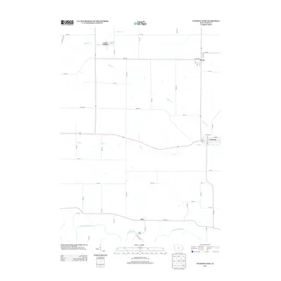
2013 Map of Wyoming West
USGS Topo · Published 2013About this map
The Wapsipinicon River curves through the southern reaches of this Jones County landscape, providing a natural anchor for the settlement at Hale and the nearby Hale Bridge. This eastern Iowa region is defined by its agricultural grid and the small towns that evolved along the transport corridors, including Wyoming in the east and Center Junction in the north. The drainage pattern is dictated by several tributaries, notably Bear Cr and Little Bear Cr, which weave through the townships between Onslow and the river valley. Genealogists and local historians can trace the specific street layouts of these rural communities, such as Main ST in Center Junction or Anamosa Ave in Onslow, which illustrate the connectivity of this prairie landscape. The map provides a clear look at the intersection of local roads and natural waterways that have shaped the development of these Jones County townships.
Find a feature on this map
49 named features on this map. Tap any name to fly to it.
Don’t see what you’re looking for? This feature index may not catch every label — zoom into the map to look around manually.
Map Details
Editions of this 2013 Wyoming West Map
This is the sole edition of this map. No revisions or reprints were ever made.
Other maps of this area

1889 · Tipton
USGS Topo · 1:62,500

1890 · Tipton
USGS Topo · 1:62,500

1891 · Monticello
USGS Topo · 1:62,500

1891 · Baldwin
USGS Topo · 1:62,500

1892 · Wheatland
USGS Topo · 1:62,500

1894 · Wheatland
USGS Topo · 1:62,500

1900 · Anamosa
USGS Topo · 1:125,000

1901 · Peosta
USGS Topo · 1:125,000

1901 · Rock Island
USGS Topo · 1:125,000

1901 · Stanwood
USGS Topo · 1:125,000