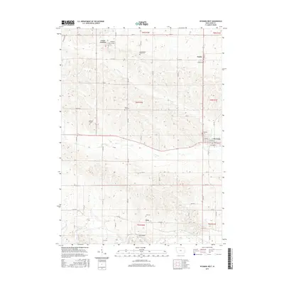
2015 Map of Wyoming West
USGS Topo · Published 2015About this map
Bear Cr and Little Bear Cr meander through the central and southern portions of this Iowa landscape, defining the rural character of Jones County in 2015. The settlement of Wyoming serves as a local hub near the eastern edge, showing a distinct grid of streets including W Webster St and N Railroad St. To the northwest, Center Junction is located near the headwaters of Mineral Cr, while the small community of Hale is situated further south, marked by the crossing at Hale Bridge. A high density of pioneer-era burial grounds reflects the deep lineage of this agricultural region. Researchers can trace local heritage through the scattered locations of the North Madison Pioneer Cem, Madison Center Cem, and the Madison Village Cem, each preserved amidst the section lines and township boundaries of T84N and T85N.
Find a feature on this map
54 named features on this map. Tap any name to fly to it.
Don’t see what you’re looking for? This feature index may not catch every label — zoom into the map to look around manually.
Map Details
Editions of this 2015 Wyoming West Map
This is the sole edition of this map. No revisions or reprints were ever made.
Other maps of this area

1889 · Tipton
USGS Topo · 1:62,500

1890 · Tipton
USGS Topo · 1:62,500

1891 · Monticello
USGS Topo · 1:62,500

1891 · Baldwin
USGS Topo · 1:62,500

1892 · Wheatland
USGS Topo · 1:62,500

1894 · Wheatland
USGS Topo · 1:62,500

1900 · Anamosa
USGS Topo · 1:125,000

1901 · Peosta
USGS Topo · 1:125,000

1901 · Rock Island
USGS Topo · 1:125,000

1901 · Stanwood
USGS Topo · 1:125,000