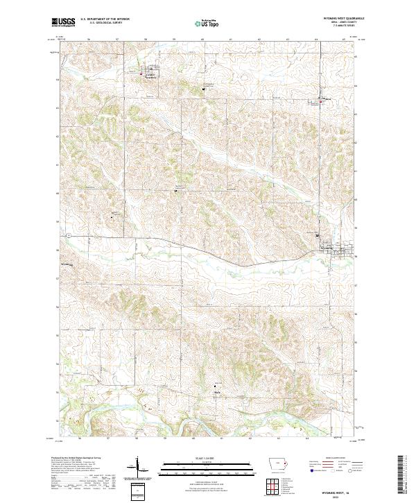
2022 Map of Wyoming West
USGS Topo · Published 2022About this map
The Wapsipinicon River meanders across the southern edge of this Jones County landscape, defining a terrain of rolling drainage systems that feed into Bear Cr and Little Bear Cr. The settlement of Wyoming serves as a local hub, situated at the intersection of several key routes including Wyoming Ave and Co Rd X75. To the north and west, the smaller communities of Onslow, Center Junction, and Hale are connected by a grid of agricultural roads such as Madison Rd and Central Park Rd. For those researching local lineages, the map is punctuated by several significant burial grounds, including the North Madison Pioneer Cem and the Madison Center Cem, which alongside the Madison Village Cem and Wyoming Cem, provide a clear spatial record of the township’s generational family settlements and early rural centers.
Find a feature on this map
53 named features on this map. Tap any name to fly to it.
Don’t see what you’re looking for? This feature index may not catch every label — zoom into the map to look around manually.
Map Details
Editions of this 2022 Wyoming West Map
This is the sole edition of this map. No revisions or reprints were ever made.
Other maps of this area

1889 · Tipton
USGS Topo · 1:62,500

1890 · Tipton
USGS Topo · 1:62,500

1891 · Monticello
USGS Topo · 1:62,500

1891 · Baldwin
USGS Topo · 1:62,500

1892 · Wheatland
USGS Topo · 1:62,500

1894 · Wheatland
USGS Topo · 1:62,500

1900 · Anamosa
USGS Topo · 1:125,000

1901 · Peosta
USGS Topo · 1:125,000

1901 · Rock Island
USGS Topo · 1:125,000

1901 · Stanwood
USGS Topo · 1:125,000