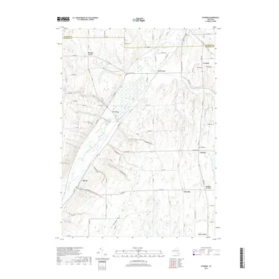
2019 Map of Wyoming
USGS Topo · Published 2019About this map
Oatka Creek carves a significant path through this section of Western New York, defining a landscape of deep ravines and prominent elevations. The village of Wyoming sits at the heart of this valley, where Cascade Brook meets the main creek near Cascade Falls. The surrounding hillsides are marked by distinctive geological features known locally as "gulfs," including Handyside Gulf, Dillon Gulf, and Holihan Gulf, which reveal the erosive power of the region's waterways over centuries.
Find a feature on this map
95 named features on this map. Tap any name to fly to it.
Don’t see what you’re looking for? This feature index may not catch every label — zoom into the map to look around manually.
Map Details
Editions of this 2019 Wyoming Map
This is the sole edition of this map. No revisions or reprints were ever made.
Other maps of this area

1904 · Batavia
USGS Topo · 1:62,500

1904 · Caledonia
USGS Topo · 1:62,500

1905 · Portage
USGS Topo · 1:62,500

1905 · Nunda
USGS Topo · 1:62,500

1943 · Mount Morris
USGS Topo · 1:24,000

1943 · Warsaw
USGS Topo · 1:24,000

1943 · Castile
USGS Topo · 1:24,000
1944 · Mount Morris
USGS Topo · 1:31,680

1944 · Stafford
USGS Topo · 1:31,680

1944 · Warsaw
USGS Topo · 1:31,680