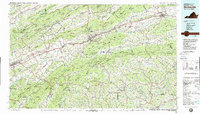
1982 Map of Wytheville
USGS Topo · Published 1988About this map
Mount Rogers and Whitetop Mountain anchor this expansive view of the Southern Highlands, where the borders of Virginia, North Carolina, and Tennessee converge. The landscape is defined by the parallel ridges of the Jefferson National Forest and the Iron Mountains, providing a look at the regional topography during the early 1980s. Major transportation corridors including Interstate 81 and the Norfolk and Western Railway follow the natural valleys, connecting historic centers like Wytheville, Marion, and Abingdon.
Find a feature on this map
112 named features on this map. Tap any name to fly to it.
Don’t see what you’re looking for? This feature index may not catch every label — zoom into the map to look around manually.
Map Details
Editions of this 1982 Wytheville Map
3 editions found
Other maps of this area

1886 · Grundy
USGS Topo · 1:125,000

1887 · Pocahontas
USGS Topo · 1:125,000

1889 · Hillsville
USGS Topo · 1:125,000

1889 · Wytheville
USGS Topo · 1:125,000

1889 · Wilkesboro
USGS Topo · 1:125,000

1890 · Grundy
USGS Topo · 1:125,000

1890 · Dublin
USGS Topo · 1:125,000

1891 · Tazewell
USGS Topo · 1:125,000

1891 · Pocahontas
USGS Topo · 1:125,000

1891 · Dublin
USGS Topo · 1:125,000