
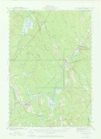
1941 Map of Wytopitlock
USGS Topo · Published 1960About this map
The Mattawamkeag River snakes through the dense woodlands of Southern Aroostook County, serving as the central artery for this 1940s landscape. Small rail-side communities like Wytopitlock and Kingman define the settlement pattern, anchored by the Central Maine R R and Canadian Pacific tracks. These villages were vital hubs in the regional timber and transport economy, with scattered educational outposts like Knoxville Sch and Drew Sch serving families in the surrounding grants.
Find a feature on this map
58 named features on this map. Tap any name to fly to it.
Don’t see what you’re looking for? This feature index may not catch every label — zoom into the map to look around manually.
Map Details
Editions of this 1941 Wytopitlock Map
2 editions found
Other maps of this area

1920 · Winn
USGS Topo · 1:62,500

1931 · Springfield
USGS Topo · 1:48,000

1934 · Springfield
USGS Topo · 1:62,500

1940 · Danforth
USGS Topo · 1:62,500

1940 · Amity
USGS Topo · 1:62,500

1940 · Sherman
USGS Topo · 1:62,500

1940 · Mattawamkeag
USGS Topo · 1:62,500

1941 · Danforth
USGS Topo · 1:62,500

1941 · Amity
USGS Topo · 1:62,500

1941 · Scraggly Lake
USGS Topo · 1:62,500