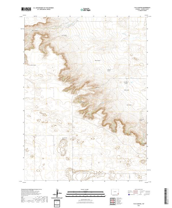
2021 Map of Y B O Canyon
USGS Topo · Published 2021About this map
Goshen Hole Rim defines the central topography of this Wyoming landscape, where the plateau drops away into a complex network of drainages. The escarpment creates a natural boundary between the high Iowa Center Flats to the south and a series of deeply incised canyons to the north and east. The named canyons, such as Barns Canyon and Sawmill Canyon, indicate a history of local resource use and ranching navigation within the broken terrain.
Find a feature on this map
32 named features on this map. Tap any name to fly to it.
Don’t see what you’re looking for? This feature index may not catch every label — zoom into the map to look around manually.
Map Details
Editions of this 2021 Y B O Canyon Map
This is the sole edition of this map. No revisions or reprints were ever made.
Other maps of this area

1899 · Goshen Hole
USGS Topo · 1:125,000

1954 · Cheyenne
USGS Topo · 1:250,000

1958 · Cheyenne
USGS Topo · 1:250,000

1960 · Veteran
USGS Topo · 1:24,000

1960 · Diamond Flat
USGS Topo · 1:24,000

1960 · Needle Rock
USGS Topo · 1:24,000
1963 · Dickinson Hill
USGS Topo · 1:24,000

1963 · C S Ranch
USGS Topo · 1:24,000

1963 · Y B O Canyon
USGS Topo · 1:24,000

1963 · Klutz Canyon
USGS Topo · 1:24,000