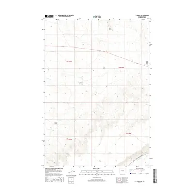
2015 Map of Y U Bench NW
USGS Topo · Published 2015About this map
Lone Tree Crossing sits at the heart of this high-desert landscape in Park County, where the topography is defined by the carved drainages of N Fork Dry Cr and the larger Dry Cr. The map illustrates a complex network of arid terrain features, from the broad Dry Creek Basin and Oregon Coulee in the west to the prominent Y U Bench in the southeast. Water management is a central theme of the lower elevations, evidenced by the Keystone Ditch and Jimmerfield Ditch near the Lower Greybull River Rd. These irrigation features represent the critical infrastructure required to support life and agriculture in the Wyoming basin. Landmark points like Red Point and the associated Red Point Draw provide sharp relief against the surrounding flats, offering a detailed look at the erosional patterns of the Big Horn Basin floor.
Find a feature on this map
15 named features on this map. Tap any name to fly to it.
Don’t see what you’re looking for? This feature index may not catch every label — zoom into the map to look around manually.
Map Details
Editions of this 2015 Y U Bench NW Map
This is the sole edition of this map. No revisions or reprints were ever made.
Other maps of this area

1911 · Oregon Basin
USGS Topo · 1:62,500

1913 · Oregon Basin
USGS Topo · 1:62,500

1951 · Y U Bench NW
USGS Topo · 1:24,000

1951 · Y U Bench NE
USGS Topo · 1:24,000

1951 · Tatman Mountain
USGS Topo · 1:24,000

1951 · Sheets Flat
USGS Topo · 1:24,000

1955 · Cody
USGS Topo · 1:250,000

1958 · Cody
USGS Topo · 1:250,000

1962 · Cody
USGS Topo · 1:250,000

1966 · Gilmore Hill SE
USGS Topo · 1:24,000