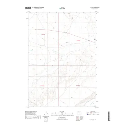
2017 Map of Y U Bench NW
USGS Topo · Published 2017About this map
Y U Bench rises above the surrounding landscape in this Park County region, illustrating the agricultural and topographic character of northern Wyoming in the early 21st century. The map depicts a network of vital irrigation infrastructure, including the Keystone Ditch and Jimmerfield Ditch, which redirect water through an otherwise arid environment defined by seasonal drainages like Dry Cr and the N Fork Dry Cr.
Find a feature on this map
14 named features on this map. Tap any name to fly to it.
Don’t see what you’re looking for? This feature index may not catch every label — zoom into the map to look around manually.
Map Details
Editions of this 2017 Y U Bench NW Map
This is the sole edition of this map. No revisions or reprints were ever made.
Other maps of this area

1911 · Oregon Basin
USGS Topo · 1:62,500

1913 · Oregon Basin
USGS Topo · 1:62,500

1951 · Y U Bench NW
USGS Topo · 1:24,000

1951 · Y U Bench NE
USGS Topo · 1:24,000

1951 · Tatman Mountain
USGS Topo · 1:24,000

1951 · Sheets Flat
USGS Topo · 1:24,000

1955 · Cody
USGS Topo · 1:250,000

1958 · Cody
USGS Topo · 1:250,000

1962 · Cody
USGS Topo · 1:250,000

1966 · Gilmore Hill SE
USGS Topo · 1:24,000