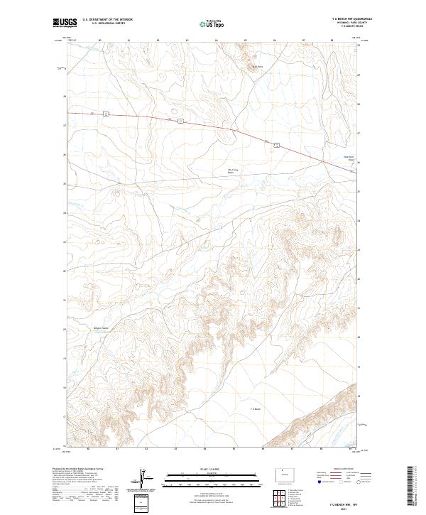
2021 Map of Y U Bench NW
USGS Topo · Published 2021About this map
Y U Bench dominates the high ground in this arid Park County landscape, where the management of water is the primary human footprint. The northern edge of the map features the Wiley Canal, while the southern reaches show the intricate paths of the Keystone Ditch and Jimmerfield Ditch. These irrigation features highlight the effort to move water across the basin's complex drainage network, which includes Dry Creek Basin and the winding N Fork Dry Cr. Notable landmarks like Red Point and Red Point Draw break the terrain, while Oregon Coulee marks a significant relief feature in the west. This 2021 survey illustrates how modern infrastructure, such as RD 3ju and RD 3le, navigates the natural cuts and plateaus that define this corner of Wyoming.
Find a feature on this map
17 named features on this map. Tap any name to fly to it.
Don’t see what you’re looking for? This feature index may not catch every label — zoom into the map to look around manually.
Map Details
Editions of this 2021 Y U Bench NW Map
This is the sole edition of this map. No revisions or reprints were ever made.
Other maps of this area

1911 · Oregon Basin
USGS Topo · 1:62,500

1913 · Oregon Basin
USGS Topo · 1:62,500

1951 · Y U Bench NW
USGS Topo · 1:24,000

1951 · Y U Bench NE
USGS Topo · 1:24,000

1951 · Tatman Mountain
USGS Topo · 1:24,000

1951 · Sheets Flat
USGS Topo · 1:24,000

1955 · Cody
USGS Topo · 1:250,000

1958 · Cody
USGS Topo · 1:250,000

1962 · Cody
USGS Topo · 1:250,000

1966 · Gilmore Hill SE
USGS Topo · 1:24,000