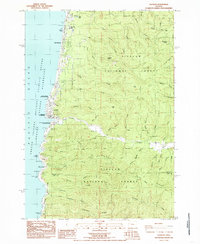
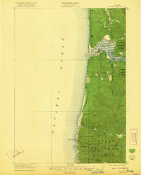
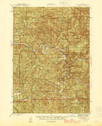
1984 Map of Yachats
USGS Topo · Published 1985About this map
The Oregon coast at Yachats is defined by a dramatic transition from the Pacific Ocean to the dense, high ridges of the Siuslaw National Forest. Surveyed in the early 1980s, this map captures the settlement patterns along Highway 101, where residential areas like San Marine and recreational sites like Tillicum Beach and Camp Angell sit just feet from the surf. The interior is a complex network of timbered ridges and creek drainages, including the Yachats River and its numerous tributaries such as North Fork Yachats River and Beamer Creek. Significant geological and topographical features mark the shoreline south of the town center, most notably the high vantage of Cape Perpetua and the wave-sculpted formations at Devils Churn and Cooks Chasm. Local history is anchored by the Carson Cem and named landmarks like Blodgett Peak, reflecting the area's logging and coastal heritage.
Find a feature on this map
58 named features on this map. Tap any name to fly to it.
Don’t see what you’re looking for? This feature index may not catch every label — zoom into the map to look around manually.
Map Details
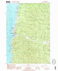
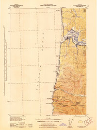
Editions of this 1984 Yachats Map
2 editions found
Other maps of this area
1918 · Mapleton
USGS Topo · 1:48,000
1920 · Heceta Head
USGS Topo · 1:62,500
1922 · Waldport
USGS Topo · 1:62,500
1940 · Mapleton
USGS Topo · 1:62,500
1942 · Waldport
USGS Topo · 1:62,500
1942 · Heceta Head
USGS Topo · 1:62,500
1942 · Tidewater
USGS Topo · 1:62,500
1945 · Mapleton
USGS Topo · 1:62,500

1953 · Salem
USGS Topo · 1:250,000

1954 · Salem
USGS Topo · 1:250,000