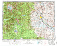
1958 Map of Yakima
USGS Topo · Published 1974About this map
Yakima and the surrounding agricultural valleys of central Washington appear here in a period of significant infrastructure growth, as captured in this 1971 revision. The landscape is defined by the sharp transition between the irrigated lowlands along the Yakima River and the high peaks of the Cascade Range to the west. The development of Interstate 82 is seen alongside the established rail corridors of the Northern Pacific and Union Pacific, illustrating the region's role as a transportation hub for the Yakima Valley's fruit and produce industries.
Find a feature on this map
56 named features on this map. Tap any name to fly to it.
Don’t see what you’re looking for? This feature index may not catch every label — zoom into the map to look around manually.
Map Details
Editions of this 1958 Yakima Map
3 editions found

Other maps of this area

1897 · Mount Stuart
USGS Topo · 1:125,000

1897 · Tacoma
USGS Topo · 1:125,000

1899 · Ellensburg
USGS Topo · 1:125,000

1900 · Tacoma
USGS Topo · 1:125,000

1901 · Ellensburg
USGS Topo · 1:125,000

1901 · Snoqualmie Pass
USGS Topo · 1:125,000

1902 · Mount Aix
USGS Topo · 1:125,000

1902 · Mount Stuart
USGS Topo · 1:125,000

1903 · Snoqualmie
USGS Topo · 1:125,000

1904 · Mt Aix
USGS Topo · 1:125,000