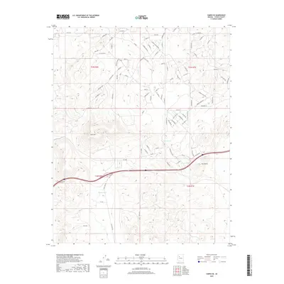
2018 Map of Yampai SE
USGS Topo · Published 2018About this map
Black Mtn and the Twin Buttes dominate this high-desert landscape in northern Yavapai County, where topographic relief is punctuated by a network of drainage features and water storage sites. Modern road development is evident through named corridors such as Bridge Canyon Pkwy and Potrero Pkwy, reflecting the expansion of infrastructure into the arid terrain. The map records several vital water points for the region, including Pot Tank, Lindburg Tank, and Freeway Tank, which are essential markers in this dry environment. The presence of Markham Wash indicates the natural drainage patterns that have shaped the land, while numerous residential or planning labels like Mesa Prwy and El Capitan Rd suggest contemporary land use and parceling within the townships of T23N R8W and T22N R8W.
Find a feature on this map
90 named features on this map. Tap any name to fly to it.
Don’t see what you’re looking for? This feature index may not catch every label — zoom into the map to look around manually.
Map Details
Editions of this 2018 Yampai SE Map
This is the sole edition of this map. No revisions or reprints were ever made.
Other maps of this area

1886 · Diamond Creek
USGS Topo · 1:250,000

1886 · Chino
USGS Topo · 1:250,000

1891 · Chino
USGS Topo · 1:250,000

1892 · Diamond Creek
USGS Topo · 1:250,000

1947 · Turkey Canyon
USGS Topo · 1:62,500

1948 · Williams
USGS Topo · 1:250,000

1950 · Turkey Canyon
USGS Topo · 1:62,500

1954 · Williams
USGS Topo · 1:250,000

1956 · Williams
USGS Topo · 1:250,000

1960 · Williams
USGS Topo · 1:250,000