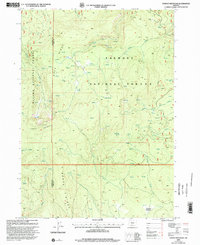
1999 Map of Yamsay Mountain
USGS Topo · Published 2002About this map
Yamsay Mountain dominates this portion of the Oregon high country, where the borders of Klamath and Lake Counties meet. This late-twentieth-century revision by the USDA Forest Service details the complex hydrology of the Fremont National Forest and Winema National Forest. A dense network of water sources, including Blue Buck Spring and the headwaters of Bridge Creek, suggests a landscape managed for both timber and seasonal grazing.
Find a feature on this map
19 named features on this map. Tap any name to fly to it.
Don’t see what you’re looking for? This feature index may not catch every label — zoom into the map to look around manually.
Map Details
Editions of this 1999 Yamsay Mountain Map
This is the sole edition of this map. No revisions or reprints were ever made.
Other maps of this area

1889 · Klamath
USGS Topo · 1:250,000

1894 · Klamath
USGS Topo · 1:250,000

1955 · Crescent
USGS Topo · 1:250,000

1955 · Klamath Falls
USGS Topo · 1:250,000

1957 · Crescent
USGS Topo · 1:250,000

1958 · Crescent
USGS Topo · 1:250,000

1958 · Klamath Falls
USGS Topo · 1:250,000

1960 · Sycan Marsh
USGS Topo · 1:62,500

1960 · Yamsay Mountain
USGS Topo · 1:62,500

1968 · Rodman Rock
USGS Topo · 1:24,000