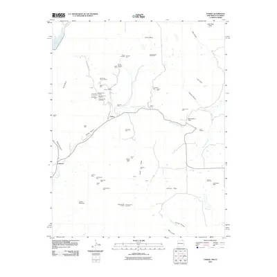
2010 Map of Yankee
USGS Topo · Published 2010About this map
The high mesas and deep canyons of Colfax County define this landscape, where the settlements of Yankee and Carisbrook sit at the center of an extensive coal mining network. Dozens of individual workings, including the Sugarite Mine, Block Coal Mine Number Two, and the New Yankee Number 4 Claim, are clustered near the New Mexico-Colorado border. This industrial footprint is etched into the terrain between Barela Mesa and Johnson Mesa, following the drainage patterns of Chicorica Creek and its East Fork.
Find a feature on this map
65 named features on this map. Tap any name to fly to it.
Don’t see what you’re looking for? This feature index may not catch every label — zoom into the map to look around manually.
Map Details
Editions of this 2010 Yankee Map
This is the sole edition of this map. No revisions or reprints were ever made.
Other maps of this area

1892 · Elmoro
USGS Topo · 1:125,000

1893 · Elmoro
USGS Topo · 1:125,000

1897 · Elmoro
USGS Topo · 1:125,000

1912 · Raton
USGS Topo · 1:62,500

1914 · Raton
USGS Topo · 1:62,500

1954 · Raton
USGS Topo · 1:250,000

1954 · Trinidad
USGS Topo · 1:250,000

1955 · Trinidad
USGS Topo · 1:250,000

1958 · Raton
USGS Topo · 1:250,000

1958 · Trinidad
USGS Topo · 1:250,000