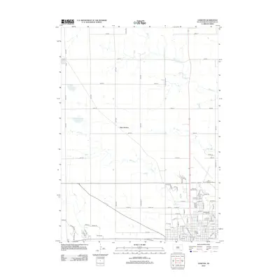
2012 Map of Yankton
USGS Topo · Published 2012About this map
Yankton College sits at the heart of the developed grid in this 2012 study of the Missouri River valley bluffs. The map illustrates a city extending northward toward the Chan Gurney Municipal Airport, while the surrounding rural landscape of Yankton County remains defined by a precise section-line road network. Hydrological features like Marne Cr and Beaver Cr cut across the high plains, influencing the placement of local landmarks such as Garden of Memories Cem and Sacred Heart Cem. To the northwest, the small settlement of Napa Junction serves as a reminder of the region's rail-oriented development. This survey documents the intersection of academic institutions, aviation infrastructure, and traditional agricultural land use during the early 21st century.
Find a feature on this map
87 named features on this map. Tap any name to fly to it.
Don’t see what you’re looking for? This feature index may not catch every label — zoom into the map to look around manually.
Map Details
Editions of this 2012 Yankton Map
This is the sole edition of this map. No revisions or reprints were ever made.
Other maps of this area

1898 · Olivet
USGS Topo · 1:125,000

1898 · Parker
USGS Topo · 1:125,000

1955 · Sioux City
USGS Topo · 1:250,000

1955 · Sioux Falls
USGS Topo · 1:250,000

1957 · Mayfield
USGS Topo · 1:24,000

1957 · Mission Hill
USGS Topo · 1:24,000

1957 · Jamesville
USGS Topo · 1:24,000

1958 · Sioux City
USGS Topo · 1:250,000

1958 · Sioux Falls
USGS Topo · 1:250,000

1959 · Sioux City
USGS Topo · 1:250,000