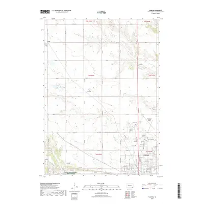
2017 Map of Yankton
USGS Topo · Published 2017About this map
The riverfront city of Yankton serves as the focal point of this 2017 survey, revealing the modern infrastructure and institutional layout of South Dakota’s territorial capital. The map details a significant concentration of civic and educational sites, including the campus of Mt Marty College and several prominent burial grounds such as Yankton City Cem and Garden of Memories Cem. To the west along the Missouri River valley, the Gavins Point National Fish Hatchery represents a major federal investment in regional conservation.
Find a feature on this map
96 named features on this map. Tap any name to fly to it.
Don’t see what you’re looking for? This feature index may not catch every label — zoom into the map to look around manually.
Map Details
Editions of this 2017 Yankton Map
This is the sole edition of this map. No revisions or reprints were ever made.
Other maps of this area

1898 · Olivet
USGS Topo · 1:125,000

1898 · Parker
USGS Topo · 1:125,000

1955 · Sioux City
USGS Topo · 1:250,000

1955 · Sioux Falls
USGS Topo · 1:250,000

1957 · Mayfield
USGS Topo · 1:24,000

1957 · Mission Hill
USGS Topo · 1:24,000

1957 · Jamesville
USGS Topo · 1:24,000

1958 · Sioux City
USGS Topo · 1:250,000

1958 · Sioux Falls
USGS Topo · 1:250,000

1959 · Sioux City
USGS Topo · 1:250,000