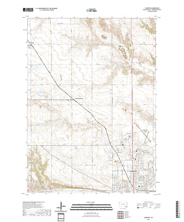
2021 Map of Yankton
USGS Topo · Published 2021About this map
Yankton serves as the focal point of this South Dakota landscape, shown here as a structured grid of streets and municipal infrastructure. The map documents the city's expansion through residential developments like Applewood Dr and the presence of significant local landmarks including the Chan Gurney Municipal Airport. This 2021 update identifies several critical genealogical sites, most notably a cluster of cemeteries on the northern edge of the city, including Sacred Heart Cem, Yankton City Cem, and the Garden of Memories Cem. Beyond the city limits, the terrain transitions into a regular township and range system where the settlements of Utica and Napa Junction sit among the drainages of Beaver Cr and Marne Cr. The network of section-line roads, such as 303rd St and 307th St, underscores the enduring agricultural framework of Yankton County.
Find a feature on this map
61 named features on this map. Tap any name to fly to it.
Don’t see what you’re looking for? This feature index may not catch every label — zoom into the map to look around manually.
Map Details
Editions of this 2021 Yankton Map
This is the sole edition of this map. No revisions or reprints were ever made.
Other maps of this area

1898 · Olivet
USGS Topo · 1:125,000

1898 · Parker
USGS Topo · 1:125,000

1955 · Sioux City
USGS Topo · 1:250,000

1955 · Sioux Falls
USGS Topo · 1:250,000

1957 · Mayfield
USGS Topo · 1:24,000

1957 · Mission Hill
USGS Topo · 1:24,000

1957 · Jamesville
USGS Topo · 1:24,000

1958 · Sioux City
USGS Topo · 1:250,000

1958 · Sioux Falls
USGS Topo · 1:250,000

1959 · Sioux City
USGS Topo · 1:250,000