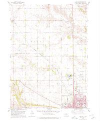
1978 Map of Yankton
USGS Topo · Published 1979About this map
The Missouri River town of Yankton serves as the focal point of this late 1970s landscape, illustrating a period of established institutional and educational development. The map details the local academic infrastructure, showing the campuses of Yankton College and several local schools like Stewart Sch and Beadle Sch. To the northwest, the settlement of Utica and the rail intersection at Napa Junction highlight the area's logistical importance, supported by the Chicago Milwaukee St Paul and Pacific railroad line.
Find a feature on this map
34 named features on this map. Tap any name to fly to it.
Don’t see what you’re looking for? This feature index may not catch every label — zoom into the map to look around manually.
Map Details
Editions of this 1978 Yankton Map
This is the sole edition of this map. No revisions or reprints were ever made.
Other maps of this area

1898 · Olivet
USGS Topo · 1:125,000

1898 · Parker
USGS Topo · 1:125,000

1955 · Sioux City
USGS Topo · 1:250,000

1955 · Sioux Falls
USGS Topo · 1:250,000

1957 · Mayfield
USGS Topo · 1:24,000

1957 · Mission Hill
USGS Topo · 1:24,000

1957 · Jamesville
USGS Topo · 1:24,000

1958 · Sioux City
USGS Topo · 1:250,000

1958 · Sioux Falls
USGS Topo · 1:250,000

1959 · Sioux City
USGS Topo · 1:250,000