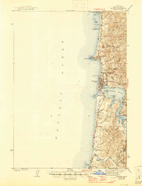
1942 Map of Yaquina
USGS Topo · Published 1946About this map
Newport serves as the central hub of this coastal survey, where the harbor at Yaquina Bay opens to the Pacific Ocean. Along the shoreline, the Oregon Coast Highway—also marked as U. S. 101—links a string of early seaside settlements including Otter Rock, Ocean Park, Beverly Beach, and Agate Beach. The map highlights important maritime and navigational landmarks such as the U. S. Coast Guard Station near the bay entrance and the prominent Yaquina Head.
Find a feature on this map
47 named features on this map. Tap any name to fly to it.
Don’t see what you’re looking for? This feature index may not catch every label — zoom into the map to look around manually.
Map Details
Editions of this 1942 Yaquina Map
2 editions found
Other maps of this area

1922 · Waldport
USGS Topo · 1:62,500

1941 · Cape Foulweather
USGS Topo · 1:62,500

1942 · Euchre Mtn
USGS Topo · 1:62,500

1942 · Waldport
USGS Topo · 1:62,500

1942 · Yaquina
USGS Topo · 1:62,500

1942 · Tidewater
USGS Topo · 1:62,500

1942 · Toledo
USGS Topo · 1:62,500

1943 · Euchre Mtn
USGS Topo · 1:62,500

1944 · Cape Foulweather
USGS Topo · 1:62,500

1953 · Salem
USGS Topo · 1:250,000