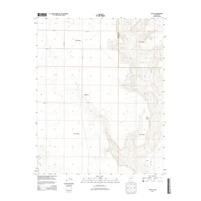
2013 Map of Yates SE
USGS Topo · Published 2013About this map
Dehaven and the small settlement of Gonzales anchor this section of the high plains, situated at the boundary of Harding and Union Counties. The landscape is dominated by the dramatic rise of Ute Creek Mesa, which cuts through the eastern half of the quadrangle with its steep escarpments and intricate drainage patterns. This 2013 survey illustrates the sparse, grid-based road network characteristic of rural northeastern New Mexico, where life is organized around expansive ranching tracts and long-distance county thoroughfares. The interplay between the flat tablelands and the broken terrain of the mesa is traced by a series of local routes including Co Road Z-1 and Gallagher Rd, providing a clear record of land use and property boundaries in this quiet corner of the state.
Find a feature on this map
14 named features on this map. Tap any name to fly to it.
Don’t see what you’re looking for? This feature index may not catch every label — zoom into the map to look around manually.
Map Details
Editions of this 2013 Yates SE Map
This is the sole edition of this map. No revisions or reprints were ever made.
Other maps of this area

1954 · Tucumcari
USGS Topo · 1:250,000

1954 · Dalhart
USGS Topo · 1:250,000

1958 · Tucumcari
USGS Topo · 1:250,000

1958 · Dalhart
USGS Topo · 1:250,000

1962 · Dalhart
USGS Topo · 1:250,000

1973 · Yates SE
USGS Topo · 1:24,000

1973 · Beenham
USGS Topo · 1:24,000

1973 · Sabino
USGS Topo · 1:24,000
1973 · Bueyeros
USGS Topo · 1:24,000
1973 · Albert
USGS Topo · 1:24,000