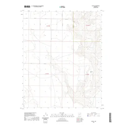
2020 Map of Yates SE
USGS Topo · Published 2020About this map
Ute Creek carves a winding path through this high plains landscape of the New Mexico panhandle, flanked by the prominent rising landform of Ute Creek Mesa. The map reflects a rural ranching environment where movement is defined by a network of county roads named for local families, including Romero Bros Rd, Lovato Rd, and Dorothy Rd. This 2020 survey documents the intersection of Harding Co and Union Co, illustrating how modern infrastructure like Dehaven Rd follows the natural contours of the mesas and creek beds. The sparse distribution of features suggests a region primarily dedicated to large-scale livestock operations, typical of the arid geography found at the transition between the Staked Plains and the Canadian River drainage system.
Find a feature on this map
18 named features on this map. Tap any name to fly to it.
Don’t see what you’re looking for? This feature index may not catch every label — zoom into the map to look around manually.
Map Details
Editions of this 2020 Yates SE Map
This is the sole edition of this map. No revisions or reprints were ever made.
Other maps of this area

1954 · Tucumcari
USGS Topo · 1:250,000

1954 · Dalhart
USGS Topo · 1:250,000

1958 · Tucumcari
USGS Topo · 1:250,000

1958 · Dalhart
USGS Topo · 1:250,000

1962 · Dalhart
USGS Topo · 1:250,000

1973 · Yates SE
USGS Topo · 1:24,000

1973 · Beenham
USGS Topo · 1:24,000

1973 · Sabino
USGS Topo · 1:24,000
1973 · Bueyeros
USGS Topo · 1:24,000
1973 · Albert
USGS Topo · 1:24,000