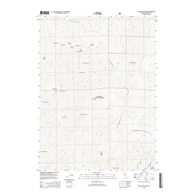
2015 Map of Yellow Dog Peak
USGS Topo · Published 2015About this map
Yellow Dog Peak and the high ridges of the Klamath National Forest define this terrain in the northern reaches of California. The map documents a landscape where the Marble Mountains meet the Salmon Mountains, characterized by steep drainage basins and alpine basins like Shelly Meadows. Water systems are central to the topography, with the Right Hand N Fork Salmon River and its numerous tributaries, including Atkins Cr and Big Cr, carving deep gulches such as Harry Hall Gulch and Deadman Gulch. A significant stretch of the Pacific Crest National Scenic Trail winds through the eastern and northern portions of the quadrangle, crossing high points near Shelly Lake and Babs Lake. This 2015 survey provides a modern record of the trail's path and the primitive names of the gulches and forks that have long served as landmarks for travelers and foresters in this high-altitude wilderness.
Find a feature on this map
43 named features on this map. Tap any name to fly to it.
Don’t see what you’re looking for? This feature index may not catch every label — zoom into the map to look around manually.
Map Details
Editions of this 2015 Yellow Dog Peak Map
This is the sole edition of this map. No revisions or reprints were ever made.
Other maps of this area

1886 · Shasta
USGS Topo · 1:250,000

1894 · Shasta
USGS Topo · 1:250,000

1914 · Seiad
USGS Topo · 1:125,000

1922 · Seiad
USGS Topo · 1:125,000

1923 · Sawyers Bar
USGS Topo · 1:125,000

1931 · Etna
USGS Topo · 1:96,000

1932 · Yreka
USGS Topo · 1:96,000

1934 · Etna
USGS Topo · 1:125,000

1939 · Yreka
USGS Topo · 1:125,000

1948 · Weed
USGS Topo · 1:250,000