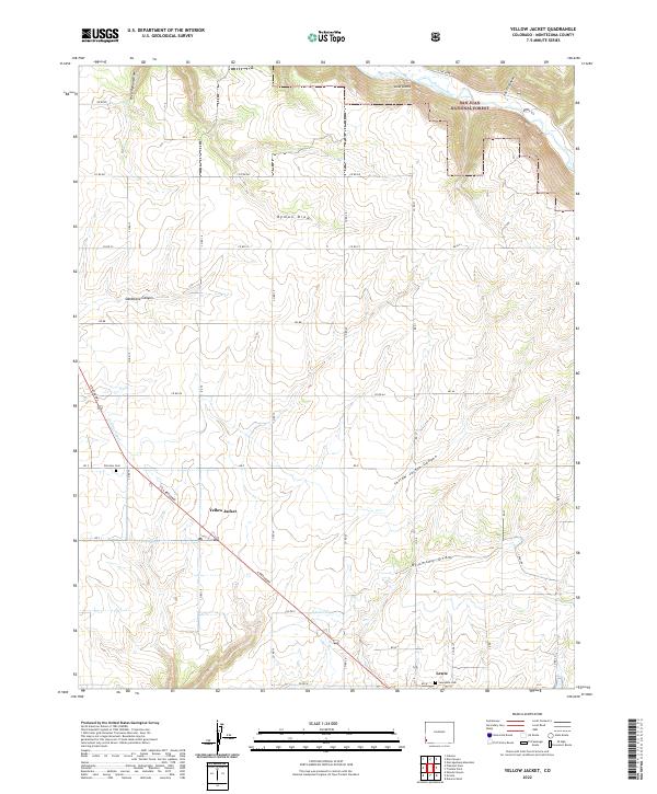
2022 Map of Yellow Jacket
USGS Topo · Published 2022About this map
The Yellow Jacket community and the nearby settlement of Lewis anchor this high-desert plateau, where the landscape is defined by deep incisions and agricultural water management. The Dolores River cuts through the northern reaches, winding past the notable landmark of Lone Dome and entering the San Juan National Forest. To the south, the Alamosa National Wildlife Refuge provides a contrast to the geometric grid of county roads that crisscross the agricultural tracts.
Find a feature on this map
36 named features on this map. Tap any name to fly to it.
Don’t see what you’re looking for? This feature index may not catch every label — zoom into the map to look around manually.
Map Details
Editions of this 2022 Yellow Jacket Map
This is the sole edition of this map. No revisions or reprints were ever made.
Other maps of this area

1956 · Cortez
USGS Topo · 1:250,000

1958 · Cortez
USGS Topo · 1:250,000

1959 · Cortez
USGS Topo · 1:250,000

1962 · Cortez
USGS Topo · 1:250,000

1965 · Cahone
USGS Topo · 1:24,000

1965 · Woods Canyon
USGS Topo · 1:24,000

1965 · Dolores West
USGS Topo · 1:24,000

1965 · Yellow Jacket
USGS Topo · 1:24,000
1965 · Arriola
USGS Topo · 1:24,000
1965 · Pleasant View
USGS Topo · 1:24,000