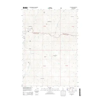
2013 Map of Yellow Pine
USGS Topo · Published 2013About this map
Yellow Pine sits at the confluence of central Idaho waterways, serving as a remote hub for the surrounding backcountry. The 2013 landscape is defined by the high elevations of the Payette National Forest and Boise National Forest, where steep ridges like Quartz Ridge and Antimony Ridge overlook narrow canyon floors. Historical family-named sites such as Abstein Place and the seasonal Antimony Camp indicate a long history of mining and homesteading in these mountains. Transportation is limited to rugged corridors like Stibnite Rd and Johnson Creek Rd, which provide the only access to the Johnson Creek Airport and the secluded Alpine Village. The presence of the Pioneer Cem near the town center provides a point of interest for genealogists tracing early settlers of the Johnson Creek drainage. Recreational sites, including the Yellow Pine Campground and Golden Gate Campground, are concentrated near the river, while landmarks like Deadhorse Rapids on the river suggest the untamed nature of the local terrain.
Find a feature on this map
38 named features on this map. Tap any name to fly to it.
Don’t see what you’re looking for? This feature index may not catch every label — zoom into the map to look around manually.
Map Details
Editions of this 2013 Yellow Pine Map
This is the sole edition of this map. No revisions or reprints were ever made.
Other maps of this area

1937 · Yellow Pine
USGS Topo · 1:48,000

1937 · Big Creek
USGS Topo · 1:48,000

1942 · Big Creek
USGS Topo · 1:62,500

1943 · Yellow Pine
USGS Topo · 1:62,500

1956 · Elk City
USGS Topo · 1:250,000

1957 · Challis
USGS Topo · 1:250,000

1960 · Elk City
USGS Topo · 1:250,000

1960 · Challis
USGS Topo · 1:250,000

1963 · Challis
USGS Topo · 1:250,000

1969 · Edwardsburg
USGS Topo · 1:24,000