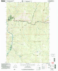
2004 Map of Yellow Pine
USGS Topo · Published 2007About this map
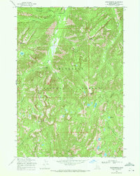
The settlement of Yellow Pine serves as the focal point for this mountain landscape, located at the confluence of Johnson Creek and the South Fork Salmon River. This area represents a critical intersection of wilderness and remote homesteading, featuring the Pioneer Cem and aviation infrastructure at the Johnson Creek Airport. The terrain is defined by massive ridgelines including Quartz Ridge and Antimony Ridge, while much of the eastern portion of the map is protected within the Frank Church - River of No Return Wilderness. Long-standing local landmarks such as the Abstein Place, Bryant Ranch, and Antimony Camp indicate a history of ranching and mining exploration, specifically near Golden Gate Hill and Bald Hill. The transition between the Payette National Forest and the Boise National Forest underscores the region's managed timber and recreational character.
Find a feature on this map
43 named features on this map. Tap any name to fly to it.
Don’t see what you’re looking for? This feature index may not catch every label — zoom into the map to look around manually.
Map Details
Editions of this 2004 Yellow Pine Map
This is the sole edition of this map. No revisions or reprints were ever made.
Other maps of this area
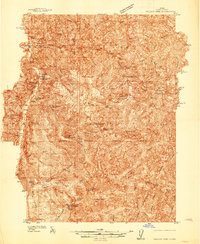
1937 · Yellow Pine
USGS Topo · 1:48,000
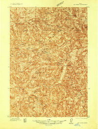
1937 · Big Creek
USGS Topo · 1:48,000

1942 · Big Creek
USGS Topo · 1:62,500
1943 · Yellow Pine
USGS Topo · 1:62,500

1956 · Elk City
USGS Topo · 1:250,000

1957 · Challis
USGS Topo · 1:250,000

1960 · Elk City
USGS Topo · 1:250,000

1960 · Challis
USGS Topo · 1:250,000

1963 · Challis
USGS Topo · 1:250,000
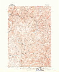
1969 · Edwardsburg
USGS Topo · 1:24,000