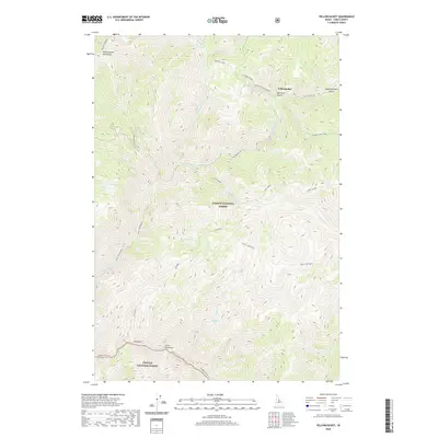
2020 Map of Yellowjacket
USGS Topo · Published 2020About this map
The Yellowjacket Mountains dominate this high-elevation landscape within the Salmon National Forest and Challis National Forest. The geography is defined by a complex network of drainage basins, including the Middle Fork River and various watercourses like Forge Creek, Anvil Creek, and Hammer Creek. Access into this backcountry is marked by the Yellowjacket Rd and the Mine Spur Yellowjacket, pointing to the area's history of mineral extraction. Higher elevations feature remote landmarks such as Hoodoo Meadows and the Hoodoo Creek Trail. The presence of Hot Springs near Forge Creek indicates the geothermal activity inherent to this part of Lemhi County, while the names of Van Horn Gulch and Slaughterhouse Gulch reflect the early ranching and mining heritage of the territory.
Find a feature on this map
34 named features on this map. Tap any name to fly to it.
Don’t see what you’re looking for? This feature index may not catch every label — zoom into the map to look around manually.
Map Details
Editions of this 2020 Yellowjacket Map
This is the sole edition of this map. No revisions or reprints were ever made.
Other maps of this area

1930 · Casto
USGS Topo · 1:125,000

1950 · Blackbird Mtn
USGS Topo · 1:62,500

1951 · Blackbird Mtn
USGS Topo · 1:62,500

1956 · Elk City
USGS Topo · 1:250,000

1957 · Challis
USGS Topo · 1:250,000

1960 · Elk City
USGS Topo · 1:250,000

1960 · Challis
USGS Topo · 1:250,000

1962 · Hoodoo Meadows
USGS Topo · 1:24,000

1962 · Puddin Mtn
USGS Topo · 1:24,000

1963 · Challis
USGS Topo · 1:250,000