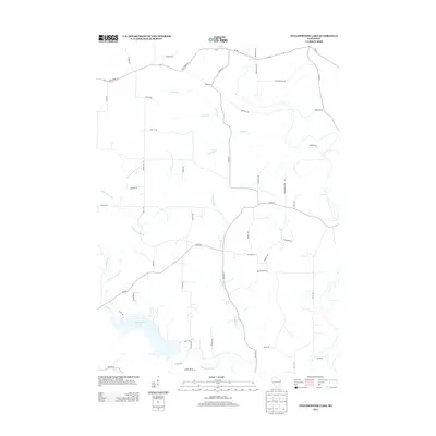
2013 Map of Yellowstone Lake
USGS Topo · Published 2013About this map
Yellowstone Lake and the meandering Yellowstone River dominate this pocket of Iowa County, Wisconsin. The landscape is defined by its complex network of cold-water tributaries, including Olson Cr, Regan Cr, and Mcclintock Cr, which carve through the rural countryside. The 2013 road network, featuring routes like Co Hwy-F and State Road 39, provides a clear view of the modern rural infrastructure used to access this recreation-heavy area. Local-history researchers will find family-named corridors such as McNeill Rd, Kelly Rd, and Dammen Ln, offering clues to the generational land ownership that has shaped this region’s development. The map’s focus on the headwaters of these various creeks provides an essential view of the watershed before it feeds into the larger Pecatonia River system to the south.
Find a feature on this map
49 named features on this map. Tap any name to fly to it.
Don’t see what you’re looking for? This feature index may not catch every label — zoom into the map to look around manually.
Map Details
Editions of this 2013 Yellowstone Lake Map
This is the sole edition of this map. No revisions or reprints were ever made.
Other maps of this area

1902 · Mineral Point
USGS Topo · 1:125,000

1923 · Blanchardville
USGS Topo · 1:62,500

1923 · South Wayne
USGS Topo · 1:62,500

1954 · Rockford
USGS Topo · 1:250,000

1955 · Rockford
USGS Topo · 1:250,000

1958 · Rockford
USGS Topo · 1:250,000

1959 · Dubuque
USGS Topo · 1:250,000

1961 · Dubuque
USGS Topo · 1:250,000

1962 · Dubuque
USGS Topo · 1:250,000
1962 · Blanchardville
USGS Topo · 1:62,500