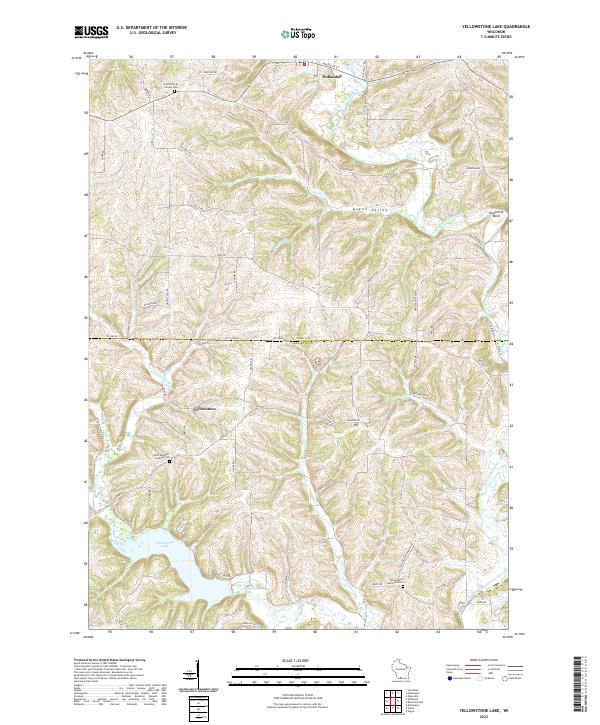
2022 Map of Yellowstone Lake
USGS Topo · Published 2022About this map
Yellowstone Lake and the winding tributaries of the Pecatonica River system define this corner of Iowa and Lafayette counties. The landscape is marked by the sharp relief of Glenn Valley and the prominent Horseshoe Bend along the East Branch Pecatonica River. This area represents a classic rural Wisconsin crossroads environment, where the small settlement of Yellowstone sits at a junction of regional roads north of its namesake lake and the Yellowstone River. To the north, the village of Hollandale serves as a local hub near the West Branch Pecatonica River. Genealogists and local historians will find several key landmarks preserved on this sheet, including Saint Michaels Catholic Cem and Yellowstone Lutheran Cem, which anchor the surrounding farmsteads. Numerous named creeks, such as Olson Cr and McClintock Cr, carve through the uplands between the river valleys.
Find a feature on this map
76 named features on this map. Tap any name to fly to it.
Don’t see what you’re looking for? This feature index may not catch every label — zoom into the map to look around manually.
Map Details
Editions of this 2022 Yellowstone Lake Map
This is the sole edition of this map. No revisions or reprints were ever made.
Other maps of this area

1902 · Mineral Point
USGS Topo · 1:125,000

1923 · Blanchardville
USGS Topo · 1:62,500

1923 · South Wayne
USGS Topo · 1:62,500

1954 · Rockford
USGS Topo · 1:250,000

1955 · Rockford
USGS Topo · 1:250,000

1958 · Rockford
USGS Topo · 1:250,000

1959 · Dubuque
USGS Topo · 1:250,000

1961 · Dubuque
USGS Topo · 1:250,000

1962 · Dubuque
USGS Topo · 1:250,000
1962 · Blanchardville
USGS Topo · 1:62,500