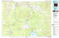
1983 Map of Yellowstone National Park North
USGS Topo · Published 1983About this map
Mammoth Hot Springs serves as the northern gateway in this 1983 study, where the geothermal activity of the Norris Geyser Basin and Monument Geyser Basin define the subterranean character of the plateau. This era of the park's management is visible in the established footprint of Canyon Village and the historic lakefront presence of the Lake Hotel and Lake Lodge near Fishing Bridge.
Find a feature on this map
142 named features on this map. Tap any name to fly to it.
Don’t see what you’re looking for? This feature index may not catch every label — zoom into the map to look around manually.
Map Details
Editions of this 1983 Yellowstone National Park North Map
This is the sole edition of this map. No revisions or reprints were ever made.
Other maps of this area

1885 · Lake
USGS Topo · 1:125,000

1885 · Gallatin
USGS Topo · 1:125,000

1885 · Gallatin
USGS Topo · 1:125,000

1886 · Shoshone
USGS Topo · 1:125,000

1886 · Canyon
USGS Topo · 1:125,000

1888 · Three Forks
USGS Topo · 1:250,000

1888 · Shoshone
USGS Topo · 1:125,000

1891 · Livingston
USGS Topo · 1:250,000

1893 · Livingston
USGS Topo · 1:250,000

1893 · Ishawooa
USGS Topo · 1:125,000