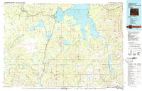
1982 Map of Yellowstone National Park South
USGS Topo · Published 1983About this map
Yellowstone Lake dominates the upper half of this 1980s landscape, serving as the central hydrological hub for a region defined by the Continental Divide. The map details the complex shoreline of the South Arm and Southeast Arm, including isolated features like Peale Island and the Molly Islands. This period shows established visitor infrastructure at Grant Village and the West Thumb geothermal area, connected by a road system that skirts Lewis Lake.
Find a feature on this map
198 named features on this map. Tap any name to fly to it.
Don’t see what you’re looking for? This feature index may not catch every label — zoom into the map to look around manually.
Map Details
Editions of this 1982 Yellowstone National Park South Map
This is the sole edition of this map. No revisions or reprints were ever made.
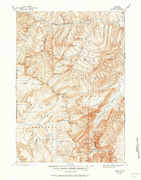
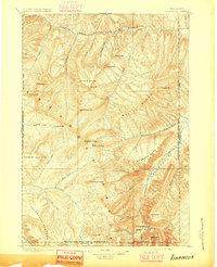
Other maps of this area

1885 · Lake
USGS Topo · 1:125,000

1885 · Gallatin
USGS Topo · 1:125,000

1885 · Gallatin
USGS Topo · 1:125,000

1886 · Shoshone
USGS Topo · 1:125,000

1886 · Canyon
USGS Topo · 1:125,000

1888 · Shoshone
USGS Topo · 1:125,000
1893 · Ishawooa
USGS Topo · 1:125,000

1895 · Shoshone
USGS Topo · 1:125,000
1895 · Ishawooa
USGS Topo · 1:125,000

1895 · Canyon
USGS Topo · 1:125,000