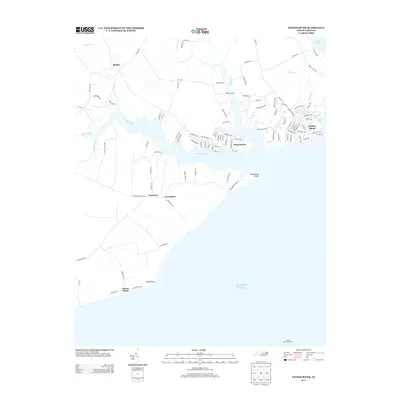
2013 Map of Yeopim River
USGS Topo · Published 2013About this map
The Yeopim River dominates this coastal landscape as it flows toward the Atlantic Ocean, shaping a network of inlets and peninsulas in Chowan County. Residential development is clustered in waterfront communities such as Snug Harbor and the geographically distinct Holiday Island, while inland settlements like Bethel and Merry Wood maintain a more rural character. The map captures the shoreline's transition from riverine creeks like Bethel Cr and Minzies Cr to the broader waters near Drummond Point and Bluff Point. Of particular note for maritime history is the Laurel Point Light House, positioned on the southern shore to guide navigation. This survey documents a modern period of coastal settlement where traditional landings like Philips Landing coexist with established beach communities such as Nixons Beach, illustrating the enduring draw of the North Carolina coast.
Find a feature on this map
102 named features on this map. Tap any name to fly to it.
Don’t see what you’re looking for? This feature index may not catch every label — zoom into the map to look around manually.
Map Details
Editions of this 2013 Yeopim River Map
This is the sole edition of this map. No revisions or reprints were ever made.
Other maps of this area

1904 · Edenton
USGS Topo · 1:62,500

1906 · Hertford
USGS Topo · 1:62,500

1940 · Hertford
USGS Topo · 1:62,500

1942 · Edenton
USGS Topo · 1:62,500

1943 · Columbia
USGS Topo · 1:125,000

1943 · Plymouth
USGS Topo · 1:125,000

1943 · Edenton
USGS Topo · 1:62,500

1953 · Norfolk
USGS Topo · 1:250,000

1953 · Columbia West
USGS Topo · 1:24,000

1953 · Rocky Mount
USGS Topo · 1:250,000