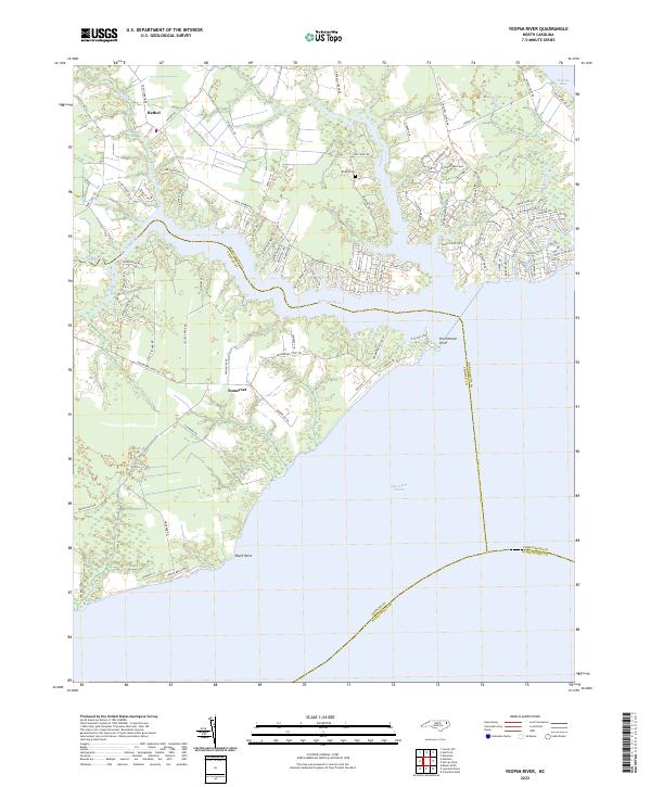
2022 Map of Yeopim River
USGS Topo · Published 2022About this map
Yeopim River flows into the expansive Albemarle Sound, defining the low-lying coastal landscape where Perquimans and Chowan counties meet. This survey captures the rural residential character of the inner banks, where local life is centered around water access and small inland settlements like Bethel and Somerset. The map reveals a high density of named residential roads and ways—such as Creecys Ln and Snug Harbor Rd—interwoven with the natural drainage systems of Bethel Creek and Yeopim Creek.
Find a feature on this map
102 named features on this map. Tap any name to fly to it.
Don’t see what you’re looking for? This feature index may not catch every label — zoom into the map to look around manually.
Map Details
Editions of this 2022 Yeopim River Map
This is the sole edition of this map. No revisions or reprints were ever made.
Other maps of this area

1904 · Edenton
USGS Topo · 1:62,500

1906 · Hertford
USGS Topo · 1:62,500

1940 · Hertford
USGS Topo · 1:62,500

1942 · Edenton
USGS Topo · 1:62,500

1943 · Columbia
USGS Topo · 1:125,000

1943 · Plymouth
USGS Topo · 1:125,000

1943 · Edenton
USGS Topo · 1:62,500

1953 · Norfolk
USGS Topo · 1:250,000

1953 · Columbia West
USGS Topo · 1:24,000

1953 · Rocky Mount
USGS Topo · 1:250,000