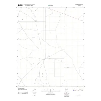
2010 Map of Yeso Mesa
USGS Topo · Published 2010About this map
Yeso Mesa and the nearby Yeso Hills define the high-desert character of this portion of De Baca County in the early 21st century. The map illustrates a landscape primarily shaped by vast open spaces and an sparse network of rural transit, including County Rd-1-58 and County Rd-1-52. Human presence is anchored at isolated points like Perez Ranch and the small settlement of Cardenas to the northwest. This area's topography, dominated by the flat-topped Yeso Mesa and the elevated Loma Alta, provides a clear view of the territorial divisions and private ranch lands that have sustained the local economy for generations. The road network connects these remote landmarks, offering a window into the infrastructure required to manage such expansive New Mexican terrain.
Find a feature on this map
13 named features on this map. Tap any name to fly to it.
Don’t see what you’re looking for? This feature index may not catch every label — zoom into the map to look around manually.
Map Details
Editions of this 2010 Yeso Mesa Map
This is the sole edition of this map. No revisions or reprints were ever made.
Other maps of this area

1954 · Fort Sumner
USGS Topo · 1:250,000

1958 · Fort Sumner
USGS Topo · 1:250,000

1966 · El Morro Mesa
USGS Topo · 1:24,000

1966 · Borica SW
USGS Topo · 1:24,000

1966 · Yeso NW
USGS Topo · 1:24,000

1978 · El Morro Ranch SE
USGS Topo · 1:24,000

1978 · El Morro Ranch
USGS Topo · 1:24,000

1979 · Fort Sumner
USGS Topo · 1:100,000

1981 · Loco Draw
USGS Topo · 1:24,000

1981 · Yeso Mesa
USGS Topo · 1:24,000