
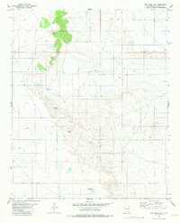
1981 Map of Yeso Mesa
USGS Topo · Published 1981About this map
The Atchison Topeka and Santa Fe railroad bisects this high-desert landscape, defining the settlement patterns of De Baca County in the early 1980s. This corridor connects small trackside points like Cardenas and Buchanan, which served as vital links in the regional transportation network. The reliance on subterranean water in this arid environment is evident from the numerous scattered improvements, including Cardenas Well, Largo Well, and Clark Well.
Find a feature on this map
15 named features on this map. Tap any name to fly to it.
Don’t see what you’re looking for? This feature index may not catch every label — zoom into the map to look around manually.
Map Details
Editions of this 1981 Yeso Mesa Map
This is the sole edition of this map. No revisions or reprints were ever made.
Other maps of this area

1954 · Fort Sumner
USGS Topo · 1:250,000

1958 · Fort Sumner
USGS Topo · 1:250,000

1966 · El Morro Mesa
USGS Topo · 1:24,000

1966 · Borica SW
USGS Topo · 1:24,000

1966 · Yeso NW
USGS Topo · 1:24,000

1978 · El Morro Ranch SE
USGS Topo · 1:24,000

1978 · El Morro Ranch
USGS Topo · 1:24,000

1979 · Fort Sumner
USGS Topo · 1:100,000

1981 · Loco Draw
USGS Topo · 1:24,000
1981 · Yeso Mesa SE
USGS Topo · 1:24,000