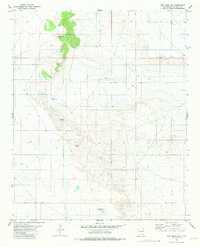
1981 Map of Yeso Mesa SE
USGS Topo · Published 1981About this map
Yeso Mesa dominates the northern landscape of this De Baca County region, where the high ground drops away into the drainage basin of Yeso Creek. The map documents a working ranching landscape in the mid-1970s, defined by a critical network of water improvements essential for livestock in this arid environment. Named water sources such as Johnson Windmill, Canyon Windmill, and Boney Well appear alongside Breaks Tank, illustrating the managed nature of the open range. The presence of C C Camp Windmill and various Drill Holes points to the area's history of survey and exploration. This survey serves as a precise record of land management and terrain elevation before more modern developments, showing the distribution of pastoral infrastructure like the East Pasture Windmill across the expansive mesas and plains.
Find a feature on this map
10 named features on this map. Tap any name to fly to it.
Don’t see what you’re looking for? This feature index may not catch every label — zoom into the map to look around manually.
Map Details
Editions of this 1981 Yeso Mesa SE Map
This is the sole edition of this map. No revisions or reprints were ever made.
Other maps of this area

1954 · Fort Sumner
USGS Topo · 1:250,000

1958 · Fort Sumner
USGS Topo · 1:250,000

1966 · El Morro Mesa
USGS Topo · 1:24,000

1966 · Yeso NW
USGS Topo · 1:24,000

1967 · Ramon
USGS Topo · 1:24,000
1967 · The Old Dry Lake
USGS Topo · 1:24,000

1967 · Wright Ranch
USGS Topo · 1:24,000

1979 · Fort Sumner
USGS Topo · 1:100,000

1981 · Loco Draw
USGS Topo · 1:24,000

1981 · Yeso Mesa
USGS Topo · 1:24,000