
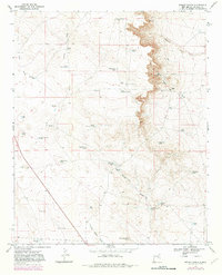
1967 Map of Wright Ranch
USGS Topo · Published 1971About this map
Wright Ranch sits at the heart of this high-plains landscape in De Baca County, where water management defines the footprint of ranching life in the late 1960s. The terrain is characterized by a network of drainage systems including Indian Draw, Burro Draw, and Loco Draw, which feed into numerous localized catchments and depressions. Names like Dipping Vat Lake and Mail Carrier Lake suggest the functional history of the region's livestock industry and early transport routes. Grounded in the 1966 aerial photography of the U.S. Geological Survey, the map meticulously records the infrastructure of the desert rangeland, from High Lonesome Windmill to specialized water sources like Mexican Lake Wells and Dunlap Camp Tank. This survey serves as a precise record of rural New Mexico before modern consolidation, preserving the locations of family-named landmarks like Berts Well and Robertson Fence Tank that were essential to the operation of high-desert ranching operations.
Find a feature on this map
42 named features on this map. Tap any name to fly to it.
Don’t see what you’re looking for? This feature index may not catch every label — zoom into the map to look around manually.
Map Details
Editions of this 1967 Wright Ranch Map
2 editions found
Other maps of this area

1954 · Fort Sumner
USGS Topo · 1:250,000

1958 · Fort Sumner
USGS Topo · 1:250,000

1966 · El Morro Mesa
USGS Topo · 1:24,000

1967 · Wire Lake
USGS Topo · 1:24,000

1967 · Devils Well
USGS Topo · 1:24,000

1967 · Ramon
USGS Topo · 1:24,000

1967 · Ramon SW
USGS Topo · 1:24,000
1967 · The Old Dry Lake
USGS Topo · 1:24,000

1979 · Fort Sumner
USGS Topo · 1:100,000

1981 · Loco Draw
USGS Topo · 1:24,000