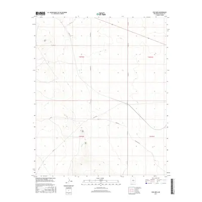
2017 Map of Yeso Mesa
USGS Topo · Published 2017About this map
Yeso Mesa and the nearby Yeso Hills anchor this high-plains landscape in De Baca County, illustrating the sparse ranching and transportation network of eastern New Mexico in the early twenty-first century. The map reveals a grid of rural routes that serve this cattle-country terrain, including Hangman Rd, El Rancho Rd, and Buffalo Range Rd. This area is characterized by isolated topographic features like Loma Alta, rising above a system of section lines and range boundaries. The presence of named roads such as Agua Buena Rd and Loma Vista Rd underscores the continued importance of access to water and vantage points in an arid environment. US Route 60 cuts across the northern edge of the sheet, providing a primary link through these townships.
Find a feature on this map
19 named features on this map. Tap any name to fly to it.
Don’t see what you’re looking for? This feature index may not catch every label — zoom into the map to look around manually.
Map Details
Editions of this 2017 Yeso Mesa Map
This is the sole edition of this map. No revisions or reprints were ever made.
Other maps of this area

1954 · Fort Sumner
USGS Topo · 1:250,000

1958 · Fort Sumner
USGS Topo · 1:250,000

1966 · El Morro Mesa
USGS Topo · 1:24,000

1966 · Borica SW
USGS Topo · 1:24,000

1966 · Yeso NW
USGS Topo · 1:24,000

1978 · El Morro Ranch SE
USGS Topo · 1:24,000

1978 · El Morro Ranch
USGS Topo · 1:24,000

1979 · Fort Sumner
USGS Topo · 1:100,000

1981 · Loco Draw
USGS Topo · 1:24,000

1981 · Yeso Mesa
USGS Topo · 1:24,000