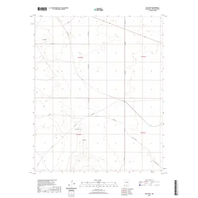
2020 Map of Yeso Mesa
USGS Topo · Published 2020About this map
Yeso Mesa and the adjacent Yeso Hills dominate this high-desert landscape in De Baca County, characterized by a sparse network of ranching and utility roads that follow the natural contours of the plateau. This 2020 survey illustrates a region defined by its wide-open topography, where local names like Loma Alta mark the high points above the surrounding plains. The transport infrastructure is primarily comprised of long-distance routes such as Agua Buena Rd and Salado Rd, which connect the remote grazing lands. Of particular note to local historians is the naming of specific rural tracks like Hangman Rd and Buffalo Range Rd, which hint at the historical cattle and ranching heritage that has shaped this part of New Mexico. The map provides a clear look at the Public Land Survey System grid across Townships 2 and 3 North, showing the layout of sections and boundaries that continue to govern land ownership today.
Find a feature on this map
19 named features on this map. Tap any name to fly to it.
Don’t see what you’re looking for? This feature index may not catch every label — zoom into the map to look around manually.
Map Details
Editions of this 2020 Yeso Mesa Map
This is the sole edition of this map. No revisions or reprints were ever made.
Other maps of this area

1954 · Fort Sumner
USGS Topo · 1:250,000

1958 · Fort Sumner
USGS Topo · 1:250,000

1966 · El Morro Mesa
USGS Topo · 1:24,000

1966 · Borica SW
USGS Topo · 1:24,000

1966 · Yeso NW
USGS Topo · 1:24,000

1978 · El Morro Ranch SE
USGS Topo · 1:24,000

1978 · El Morro Ranch
USGS Topo · 1:24,000

1979 · Fort Sumner
USGS Topo · 1:100,000

1981 · Loco Draw
USGS Topo · 1:24,000

1981 · Yeso Mesa
USGS Topo · 1:24,000