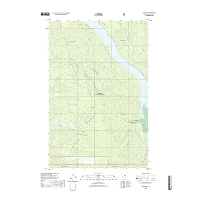
2020 Map of Yew Creek
USGS Topo · Published 2020About this map
The Mission Range dominates this landscape, where the high ridges of the Flathead National Forest descend toward the glacial waters of Swan Lake. This 2020 survey documents a complex network of forest development roads and seasonal routes, including the Crane Mtn Snowmobile trail and its various spurs that navigate the steep drainages of Crane Creek and Parker Creek. Along the eastern edge of the map, the Swan River flows into the protected wetlands of the Swan River National Wildlife Refuge, a critical riparian habitat situated between the mountains and the smaller waters of Weed Lake. Numerous family-named and geographic creeks, such as Gunderson Creek, Bohannon Creek, and Henry Creek, carve through the terrain, illustrating the intricate drainage patterns of the Seeley-Swan Valley before they reach the main river corridor.
Find a feature on this map
51 named features on this map. Tap any name to fly to it.
Don’t see what you’re looking for? This feature index may not catch every label — zoom into the map to look around manually.
Map Details
Editions of this 2020 Yew Creek Map
This is the sole edition of this map. No revisions or reprints were ever made.
Other maps of this area

1914 · Nyack
USGS Topo · 1:125,000

1920 · Flathead Lake
USGS Topo · 1:125,000

1943 · Kalispell
USGS Topo · 1:125,000

1955 · Choteau
USGS Topo · 1:250,000

1956 · Wallace
USGS Topo · 1:250,000

1957 · Choteau
USGS Topo · 1:250,000

1957 · Kalispell
USGS Topo · 1:250,000

1958 · Choteau
USGS Topo · 1:250,000

1960 · Kalispell
USGS Topo · 1:250,000

1960 · Wallace
USGS Topo · 1:250,000