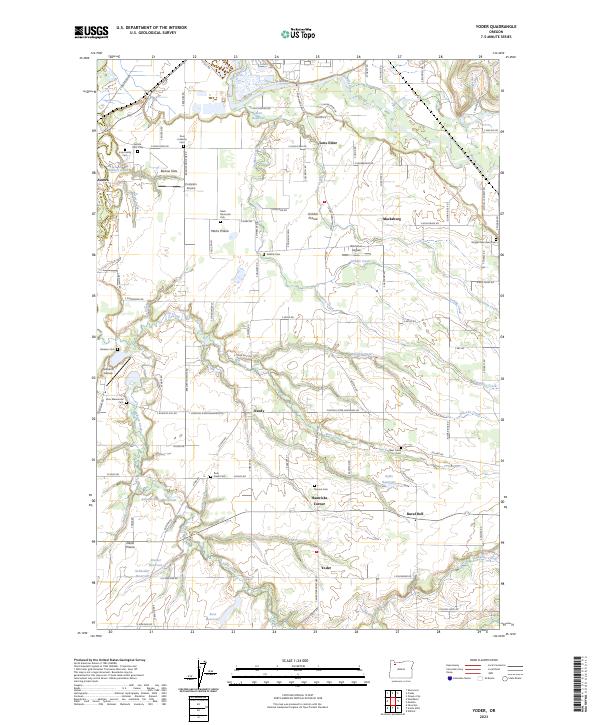
2023 Map of Yoder
USGS Topo · Published 2023About this map
Aurora and the surrounding agricultural landscapes of Clackamas County and Marion County define this 2023 survey. The terrain transitions from the low-lying Barlow Flats in the northwest to the higher Gribble Prairie and Marks Prairie, reflecting a region long shaped by its proximity to the Molalla River and Milk Creek. A dense network of local cemeteries, including the Aurora IOOF Cem, Zoar Lutheran Cem, and the family-named Irvin Family Cem, provides a map of the area's genealogical roots. Small rural centers and crossroads like Macksburg, Needy, Rural Dell, and Yoder are connected by a grid of named roads and the Southern Pacific RR corridor. The presence of several private airfields, such as Compton Airport and Vorkman Airpark, highlights the modern character of these traditional prairies.
Find a feature on this map
107 named features on this map. Tap any name to fly to it.
Don’t see what you’re looking for? This feature index may not catch every label — zoom into the map to look around manually.
Map Details
Editions of this 2023 Yoder Map
This is the sole edition of this map. No revisions or reprints were ever made.
Other maps of this area

1914 · Oregon City
USGS Topo · 1:62,500

1916 · Tualatin
USGS Topo · 1:62,500

1923 · Mount Angel
USGS Topo · 1:62,500

1939 · Molalla
USGS Topo · 1:62,500

1939 · Oregon City
USGS Topo · 1:62,500

1939 · Tualatin
USGS Topo · 1:62,500

1940 · Tualatin
USGS Topo · 1:62,500

1940 · Molalla
USGS Topo · 1:62,500

1940 · Mount Angel
USGS Topo · 1:62,500

1941 · Oregon City
USGS Topo · 1:62,500