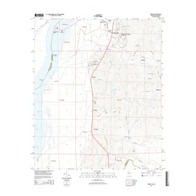
2015 Map of Yokena
USGS Topo · Published 2015About this map
The Mississippi River forms a dynamic western boundary for this southern Warren County landscape, characterized by dramatic meanders like Bedford Bend and the Diamond Island Cutoff. The river's influence is evident in the complex network of waterways, including Hennesseys Bayou and Paces Bayou, which snake through the lowlands before the terrain rises into the dissected uplands to the east. This transition from alluvial plain to hill country is marked by small settlements such as Yokena and Kimberly, which sit along the primary north-south corridor leading toward Vicksburg.
Find a feature on this map
80 named features on this map. Tap any name to fly to it.
Don’t see what you’re looking for? This feature index may not catch every label — zoom into the map to look around manually.
Map Details
Editions of this 2015 Yokena Map
This is the sole edition of this map. No revisions or reprints were ever made.
Other maps of this area

1909 · Mound
USGS Topo · 1:24,000

1910 · Mound
USGS Topo · 1:31,680

1918 · Vicksburg
USGS Topo · 1:62,500

1939 · Talla Bena
USGS Topo · 1:62,500

1939 · Yokena
USGS Topo · 1:62,500

1941 · Vicksburg
USGS Topo · 1:62,500

1955 · Jackson
USGS Topo · 1:250,000

1961 · Jackson
USGS Topo · 1:250,000

1962 · Jackson
USGS Topo · 1:250,000

1962 · Vicksburg West
USGS Topo · 1:24,000