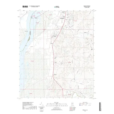
2018 Map of Yokena
USGS Topo · Published 2018About this map
The Mississippi River creates a dynamic western boundary for this Warren County landscape, where the shifting riverbed has formed complex features like Reid-Bedford Bend and the Diamond Island Cutoff. The transition from the alluvial floodplain to the eastern uplands is marked by a string of small settlements and family-named cemeteries that reflect the area's deep-rooted rural history. Communities such as Yokena, Simrall, and Le Tourneau are connected by a network of local roads that navigate around significant water bodies including Hennesseys Bayou and Paces Bayou. To the north, the southern outskirts of Vicksburg and the Vicksburg Municipal Airport show the encroachment of municipal infrastructure, while the south remains dominated by the natural drainage of the Big Black River and Campbell Swamp. This area maintains its agricultural and river-oriented character, with numerous legacy sites like Mount Giving Cem and Beard Cem preserved among the fields.
Find a feature on this map
82 named features on this map. Tap any name to fly to it.
Don’t see what you’re looking for? This feature index may not catch every label — zoom into the map to look around manually.
Map Details
Editions of this 2018 Yokena Map
This is the sole edition of this map. No revisions or reprints were ever made.
Other maps of this area

1909 · Mound
USGS Topo · 1:24,000

1910 · Mound
USGS Topo · 1:31,680

1918 · Vicksburg
USGS Topo · 1:62,500

1939 · Talla Bena
USGS Topo · 1:62,500

1939 · Yokena
USGS Topo · 1:62,500

1941 · Vicksburg
USGS Topo · 1:62,500

1955 · Jackson
USGS Topo · 1:250,000

1961 · Jackson
USGS Topo · 1:250,000

1962 · Jackson
USGS Topo · 1:250,000

1962 · Vicksburg West
USGS Topo · 1:24,000